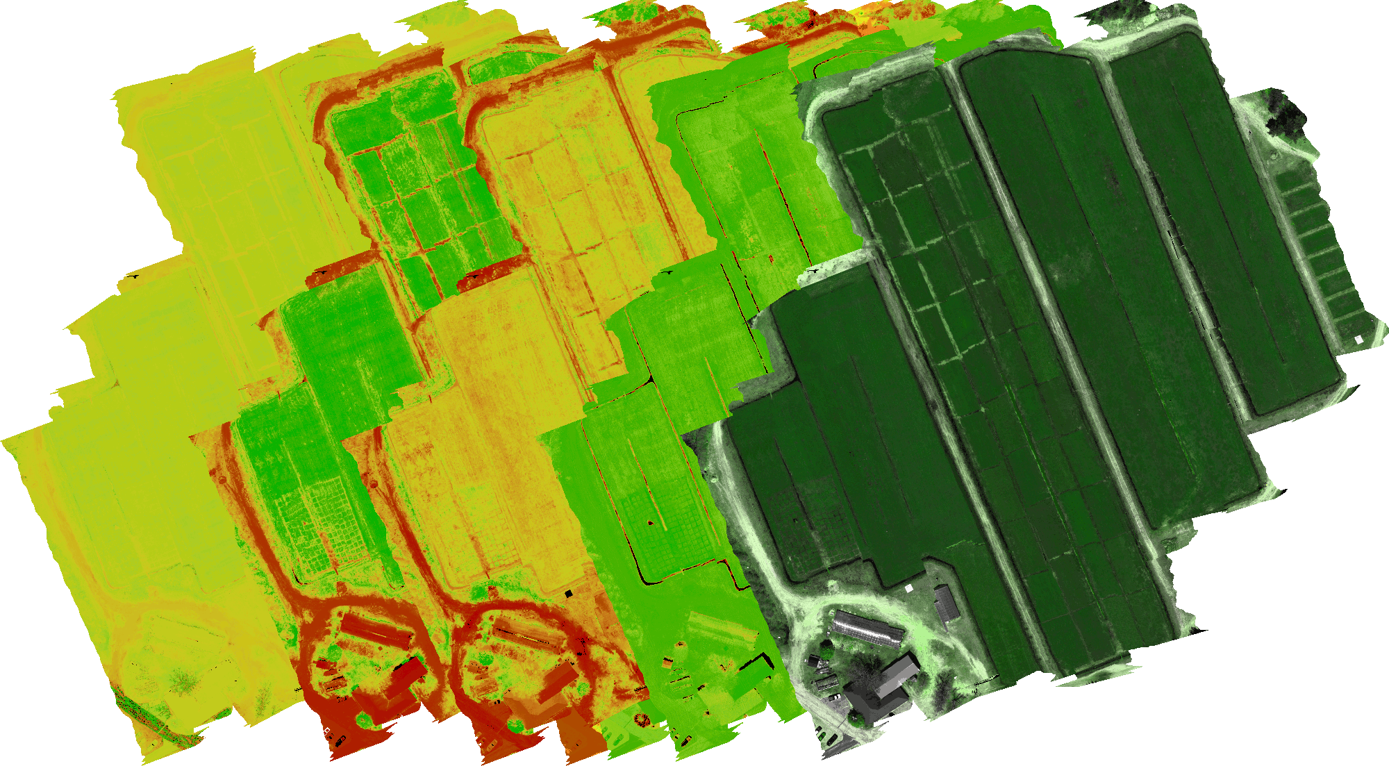
Extended indices are mathematical formulas used to compare multispectral and hyperspectral remote sensing. Multispectral remote sensing uses several bands of data from various wavelengths to analyze an area of land. Hyperspectral remote sensing uses hundreds or thousands of bands of data from very specific wavelengths to analyze an area of land. Extended indices are used to measure and compare the differences between the two types of remote sensing. They measure the difference in spectral information, the spatial resolution, and the radiometric resolution of each type of data. By comparing the two, researchers can determine which type of remote sensing is best suited for a particular application. tag
Multispectral remote sensing and hyperspectral remote sensing are two different types of remote sensing technologies used for acquiring data from the earth. Multispectral remote sensing is the process of capturing radiation in multiple different bands of the electromagnetic spectrum, usually in the visible and near-infrared. Hyperspectral remote sensing is the process of capturing radiation in much finer bands of the spectrum than multispectral remote sensing, usually in the visible, near-infrared, and shortwave infrared. The advantages of multispectral remote sensing over hyperspectral remote sensing include its ability to capture images with a greater spatial resolution, its lower cost, and its ability to capture larger areas of land with one image. Hyperspectral remote sensing has the advantage of capturing data with a much finer resolution than multispectral remote sensing, allowing for the identification of more specific features and objects in an image. Additionally, hyperspectral remote sensing has the ability to detect certain features and objects that multispectral remote sensing may not be able to detect, such as minerals and the chemical composition of the atmosphere. Both multispectral and hyperspectral remote sensing have their advantages and disadvantages depending on the application, making it important to determine which type of remote sensing best suits the needs of the user.
Differences in Spectral Resolution between Multispectral and Hyperspectral Remote Sensing
Multispectral and hyperspectral remote sensing are both types of electromagnetic remote sensing used to obtain information about the Earth’s surface. The primary difference between the two is that multispectral data has fewer spectral bands than hyperspectral data, with each band having a much wider spectral range. As a result, multispectral data is less accurate at detecting subtle differences between materials on the Earth’s surface, while hyperspectral data is more accurate. Additionally, multispectral data is usually collected using a single instrument, while hyperspectral data is usually collected using multiple instruments, giving greater accuracy and allowing for more detailed analysis. Finally, multispectral data is usually used to detect large-scale features, such as land cover types, while hyperspectral data is used to detect more detailed features, such as the composition of materials. Both multispectral and hyperspectral data have their advantages and disadvantages, and the choice of which type of data to use for a given application depends on the particular needs of the user. tags
Applications of Multispectral and Hyperspectral Remote Sensing
Multispectral and hyperspectral remote sensing are two types of remote sensing technology which are used to collect information about the Earth’s surface. Multispectral remote sensing collects data in multiple narrow spectral bands, while hyperspectral remote sensing collects information in hundreds of very narrow spectral bands. This technology can be used to identify and map different surface features like vegetation, water bodies and structures. It can also be used to detect and monitor changes in surface features over time. Multispectral and hyperspectral remote sensing can be used for a variety of applications including agriculture, forestry, geology, hydrology, and mineral exploration. In agriculture, multispectral and hyperspectral remote sensing can be used to detect crop stress, monitor crop health and production, and detect and map weeds. In forestry, it can be used to map and monitor vegetation health, detect forest fires, and monitor changes in land cover. In geology, it can be used to map geological features and identify areas of potential mineral deposits. In hydrology, it can be used to map and monitor water bodies and detect changes in water level. In mineral exploration, it can be used to detect and map areas of potential mineral deposits. tag
Extended Indices for Improved Analysis of Multispectral and Hyperspectral Remote Sensing Data
Multispectral and hyperspectral remote sensing data is an extremely valuable resource for many different applications, ranging from land cover and land use mapping to crop health assessment. The analysis of this data often relies on the use of indices that are derived from the spectral information contained in the data. Traditional indices, such as the Normalized Difference Vegetation Index (NDVI), are useful for distinguishing vegetation from other land cover classes, but are limited in their ability to detect subtle differences between land cover types or to identify specific vegetation types. To address this limitation, researchers have developed a range of extended indices that are designed to provide a more detailed analysis of the spectral data. These indices can be used to identify specific vegetation types, to detect subtle changes in vegetation health, and to identify land cover types that are difficult to distinguish using traditional indices. By combining traditional indices with extended indices, it is possible to gain a more comprehensive understanding of the data and to make more accurate interpretations. tags
Extended Indices are More Accurate with Hyperspectral Remote Sensing than Multispectral Remote Sensing
Extended indices are a type of remote sensing index that uses a combination of spectral bands to calculate an index that can better quantify the characteristics of an object or an area. Extended indices are used in remote sensing to improve the accuracy of the results compared to traditional indices. Multispectral remote sensing generally uses a limited number of bands and therefore results in less accurate indices than hyperspectral remote sensing, which uses more bands. Thus, when using extended indices, hyperspectral remote sensing is more accurate than multispectral remote sensing.

